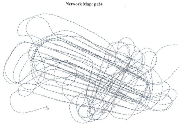
GPS log from the aerial photography over Hamar on June 5, 1996. Project 24, 21 rolls of film were taken. Some of the clean circles were what we called 360, simply changing the film and returning to the same position to continue. GPS was not common at that time. The pilot had no screen to look at; flying was purely visual. Two GPS systems were necessary, one of which was a base station. Battery and memory capacity were significant issues, so logging occurred only every third second, resulting in slightly longer turns. The GPS units had a neat cost of EUR 40,000 (2024 cost).