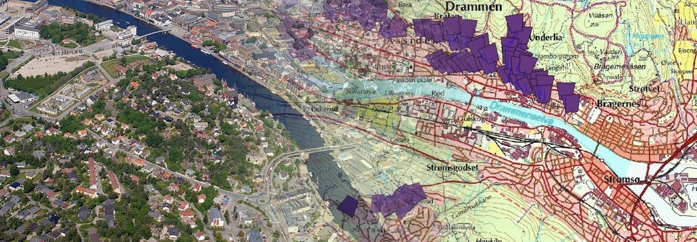
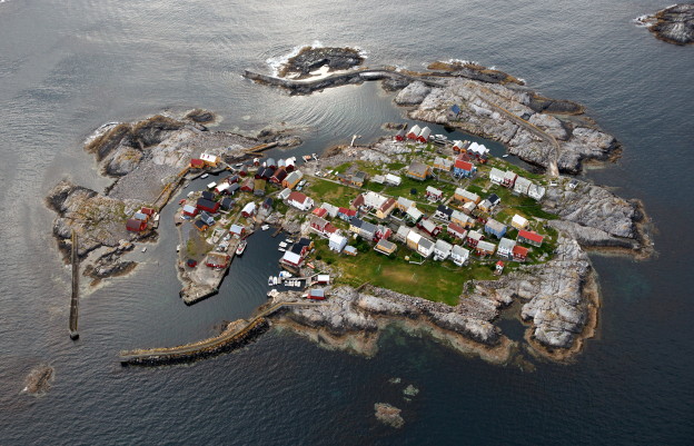
Skråfoto er flyfotografering skrått ut av flyet. Tradisjonelt betyr flyfoto bilder tatt i sammenheng med fotografering til kartproduksjon. Bruken av skråfotoene i kommunal sammenheng avgrenser seg selvfølgelig til om de har bildene. Det blir fort vanskeligere for privatpersoner.
Sak 1: En person kontaktet meg. Problemet var at han hadde kjøpt en toppleilighet, men at verandaen/uteplassen var ikke godkjent eller i arkivet. Kommunen fant heller ikke noe i sine fotoarkiver. Kjøperen av nummer fem over 25 år og noen spørsmål i den rekken ga svaret at uteplassen alltid hadde vært der. I mitt arkiv et 27 år gammelt bilde ga svaret, den var der i 1996.
Sak 2: Jeg blir oppringt. En kar hadde begynt å reparere en brygge. Den var gammel og bestod stort sett av stein, stor stein. Folk fra kommunen beordret stopp “Ulovelig”. De så ikke steinen under vann, og kystlinjen så urørt ut på alt av kartverk. Poenget var å vise steinene i sjøen, gjerne langt tilbake. 21 år gamle bilder fra mitt arkiv ble hans redning.
Sak 3: En arkitekt ringte. Han hadde ledet byggingen av en hytte nær sjøen etter at de hadde fått tillatelse å rive to eldre falleferdige fritidsbygg. Alt gikk såre vel. Adgangen til sjøen var vanskelig, og trappen ned til sjøen var svært dårlig. De bygget ny, og reaksjonen kom fra kommunen rett etter: “Der har det aldri vært noen trapp”. Igjen var bilder redningen, denne gangen 21 år gamle. Saken ble reddet.
Siste sak nå, ut av mange, mange flere.
Sak 4: En familie hadde kjøpt en eiendom med tre meter strandlinje. Tre menn fra kommunen gikk over strandlinjen og lette bokstavelig talt etter ulovligheter. Et mangefasetters brev til grunneier med krav om tilbakestilling. Saken hadde tatt mye tid og tok fortsatt mye tid, inntil grunneier fant fram til meg. Kommunen hadde gått gjennom alt av bildemateriell og fant ikke spor av noen aktivitet på parsellen. Alt ble løst når jeg fant fram bilder fra 1993. Det var klart grunneier hadde rett. Resultatet ble en heftig diskusjon hvor spørsmålet ble “Hvorfor satt ikke kommunen med dette bildemateriellet? De kunne spart seg selv tid og ikke minst spart seg i forhold til å påføre helt unødvendig ubehag ovenfor privatpersoner.
Men for all del, stopp ulovlig bygging!
————————————-
Oblique photos are taken at an angle from the aircraft. Traditionally, aerial photos refer to images taken in conjunction with mapping photography. The use of oblique photos in a municipal context naturally depends on whether they have the images. It quickly becomes more challenging for private individuals.
Case 1: A person contacted me. The issue was that he had purchased a penthouse, but the veranda/patio was not approved or in the records. The municipality also found nothing in its photo archives. The buyer of number five over 25 years and some questions in that regard gave the answer that the patio had always been there. In my archive, a 27-year-old photo provided the answer; it was there in 1996.
Case 2: I received a call. A guy had started repairing a pier. It was old and mostly made of large stones. Municipal officials ordered a stop, claiming it was “illegal.” They did not see the stones underwater, and the coastline appeared untouched on all maps. The point was to show the stones in the sea, preferably far back. 21-year-old photos from my archive became his salvation.
Case 3: An architect called. He had overseen the construction of a cottage near the sea after receiving permission to demolish two older, dilapidated recreational buildings. Everything went very well. Access to the sea was difficult, and the stairs down to the sea were very poor. They built a new one, and the reaction from the municipality came right after: “There has never been any stairs there.” Again, pictures were the savior, this time 21 years old. The case was saved.
The last case now, out of many, many more.
Case 4: A family had purchased a property with three meters of shoreline. Three men from the municipality walked along the shoreline and literally searched for violations. A multi-page letter to the landowner demanding restoration. The case had taken a lot of time and continued to take a lot of time until the landowner found me. The municipality had gone through all the photographic material and found no traces of any activity on the plot. Everything was resolved when I found pictures from 1993. It was clear the landowner was right. The result was a heated discussion, with the question being, “Why didn’t the municipality have this photographic material? They could have saved themselves time and, not least, spared themselves from causing completely unnecessary discomfort to private individuals. But by all means, stop illegal construction!

