Tag Archives: Flyfoto

Aerial photography, GPS systems

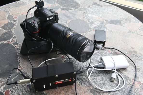
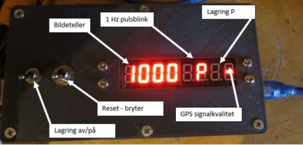
Aerial photography may require additional information, such as position data. I just received GPS box no. 2, a specially built device that registers position, time, and more for the photographs in a plain, simple text file. The registration of the photo point comes via the cable from the camera’s flash shoe. We have had some challenges with the solution, as noise from the aircraft’s engine has reduced the photo point signal. Now, we have a solution for that too. The data file itself must also go through some conversion steps before everything is transferred to GIS (Geographic Information Systems).

In aerial photography

In aerial photography, the registration of the flight and photography points is essential. To accomplish this, certain equipment needs to be in place, and one such piece is: “Norway’s answer to Mr. Q, Kristian Fahlstrøm, the head of Q Branch (later Q Division), the fictional research and development division of the Secret Service, has assembled and arranged a small box weighing just a few hundred grams, which both collects GPS data and registers photography points. This equipment is significantly lighter than the 40-50 kilos with equipment and batteries that were in use some years ago.”

Nesodden, Norway 2000

In the year 2000, the coastline of Nesodden municipality, south of Oslo, Norway, was extensively photographed. Today, these types of images are used for documentation purposes. A one-hundred-meter belt around the coast is particularly protected from development and interference. In conflicts involving, among other things, legal dock installations, these types of images can be crucial. Photo date: June 7, 2000, totaling 215 images.