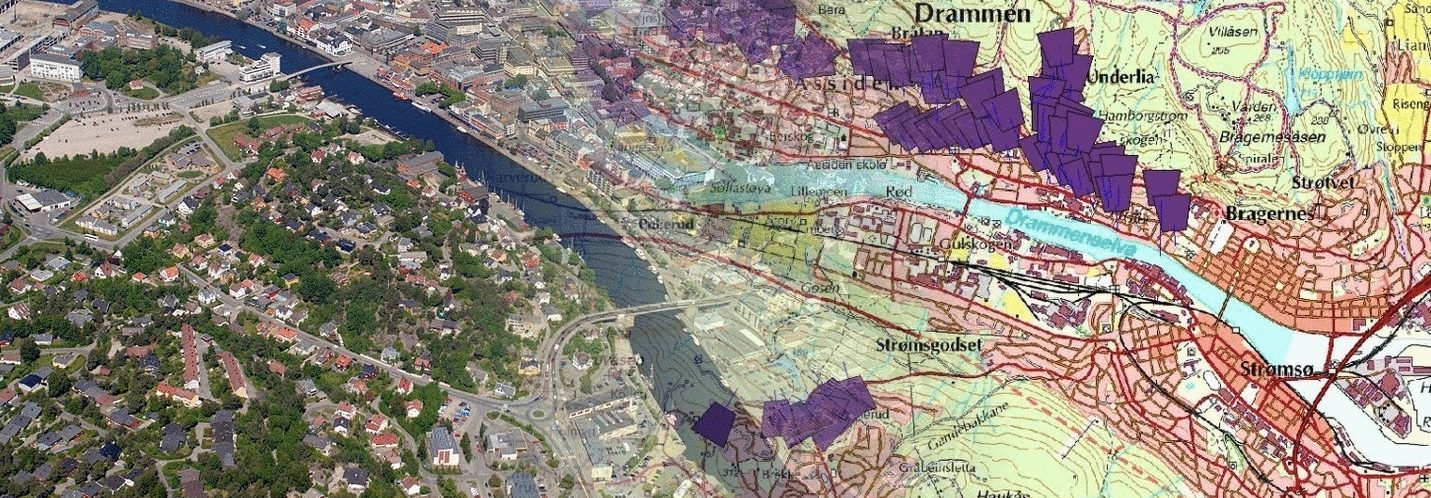
Historisk perspektiv: Eldre skråfoto gir et verdifullt historisk perspektiv som kan være nyttig for å forstå endringer i landskapet over tid. Dette kan være spesielt relevant for arealplanlegging, byutvikling og miljøovervåking.
Kartlegging av endringer: Ved å sammenligne eldre skråfoto med nyere bilder kan man identifisere og kartlegge endringer i infrastruktur, vegetasjon og bebyggelse. Dette er viktig for å oppdatere kartdata og forvalte ressurser effektivt.
Dokumentasjon av kulturminner: Eldre skråfoto kan være en verdifull kilde for å dokumentere og bevare kulturminner og historiske steder. Dette kan styrke kulturminnevernet og bidra til bevaring av kulturarv.
Planlegging og utvikling: For offentlig forvaltning kan eldre skråfoto være til nytte i planlegging og utvikling av områder. Det gir beslutningstakere et bedre grunnlag for å vurdere tidligere beslutninger, forutse endringer og planlegge for fremtiden.
Klimaendringer: Eldre skråfoto kan bidra til å forstå klimaendringer og deres påvirkning på landskapet. Ved å analysere endringer over tid kan man få innsikt i hvordan klimaet påvirker naturressurser og samfunn.
Kostnadseffektivitet: Bruk av eldre skråfoto kan være kostnadseffektivt, spesielt hvis det ikke er nødvendig å oppdatere bilder hyppig. Dette kan frigjøre ressurser som ellers ville blitt brukt på hyppige oppdateringer og vedlikehold.
Samlet sett kan eldre skråfoto være en verdifull ressurs for offentlig forvaltning ved å gi innsikt, støtte beslutningstaking og bidra til bærekraftig utvikling.
————————————————–
Historical Perspective: Older oblique aerial photos provide a valuable historical perspective that can be useful in understanding changes in the landscape over time. This can be particularly relevant for land-use planning, urban development, and environmental monitoring.
Mapping Changes: By comparing older oblique aerial photos with more recent images, one can identify and map changes in infrastructure, vegetation, and buildings. This is crucial for updating map data and managing resources efficiently.
Documentation of Cultural Heritage: Older oblique aerial photos can be a valuable source for documenting and preserving cultural heritage sites. This can enhance cultural heritage conservation efforts and contribute to the preservation of cultural assets.
Planning and Development: For public administration, older oblique aerial photos can be beneficial in planning and developing areas. It provides decision-makers with a better foundation for assessing past decisions, anticipating changes, and planning for the future.
Climate Change: Older oblique aerial photos can contribute to understanding climate change and its impact on the landscape. By analyzing changes over time, insights into how climate affects natural resources and societies can be gained.
Cost Efficiency: The use of older oblique aerial photos can be cost-effective, especially if frequent updates are not necessary. This can free up resources that would otherwise be spent on frequent updates and maintenance.
Overall, older oblique aerial photos can be a valuable resource for public administration by providing insights, supporting decision-making, and contributing to sustainable development.